Showing posts sorted by relevance for query June Lake. Sort by date Show all posts

Friday, May 25, 2012

Around June Lake

How is it possible that after 16 years of traveling the USA, Canada & Mexico, and living in California most of my life, I have never been to June Lake, or most of the places we have visited and intend to visit along Hwy 395.  More importantly, arriving at a destination such as this and still being completely overwhelmed by its beauty; it just never gets ho-hum!


Our home for a week, taking us through the Memorial Weekend until..whenever our mail arrives, is the Oh! Ridge Campground, located near the southern entrance of the scenic June Lake Loop, Hwy 158.  The Oh! refers to the spectacular views from our perch above this placid turquoise or emerald lake (depending on the angle of the sun),  framed by jagged granite peaks, and pine forested hillsides.  Our cost for the week is $83 with Golden Access Pass, no hookups but services available.  And once again, our drive from Bridgeport was 40 miles!  Rationing our use of diesel fuel is a good thing.


Oh Ridge campground above June Lake


This Deer Brush shrub is so fragrant with its tiny yellow flowers

From our base camp there is much to see and do:  Mono Lake, Lee Vining, Tioga Pass and the eastern entrance to Yosemite NP, Mammoth Lakes and Devil's Postpile, scenic backroads and hikes.  But for now we'll show you around the loop.


Driving thru town 

Cute and colorful

Next door to June Lake is Gull Lake 


You can't miss Horsetail Falls erupting down from Rush Creek at peak flow this time of year!


Spectacular Silver Lake..


With Grant Lake at the north end of the loop.  


All of these lakes provide excellent fishing, from what we've been told, and they all have Forest Service campgrounds.  There are several full service private RV parks as well.  The town of June Lake offers a variety of restaurants, a grocery store, and shops in a lovely alpine setting.  

We are situated at an altitude of 7700' which takes a bit of acclimating before attempting serious hikes.  Just walking down to the beach and back to our campsite has me out of breath!  The temps all week have been in the mid to high 70s...until today, and now it's snowing!


Glorious!

Front door shots...welcome!

Monday, May 28, 2012

A day along the way..The WHOLE story!

Note to self:  Probably best not to post when tired, after a long day...and a glass of wine.  It's the Save tab not the Publish!  So back to our day...


Remember this is Memorial Day weekend, Saturday to be exact (for this outing).  We were up early and ready to experience the upper Yosemite NP, along Tioga Pass.  Not happening, after last night's snow, the pass is closed.  No problem, we'll just head over to Mammoth and Devil's Postpile Nat'l Monument.  Well,  Mammoth Mountain is the premier skiing destination for the Southern CA area and silly us forgot that this particular weekend would be the die-hards' last chance at killing the slopes.  The area was a traffic gridlock, plus snow falling and visibility nil...no chance of finding parking, much less the shuttle to ferry us to Devil's Postpile which, by the way, is closed due to major repairs after a severe windstorm last November!


Let's get going!

Stopped for coffee in Lee Vining after seeing Tioga Pass is closed

Mammoth..not an attractive prospect


Not to be deterred we decide to check out Bishop, about 50 miles south, for places to stay when we leave June Lake.  Never made it!  There were just too many side roads and black dotted tracks on our map that begged to be explored.  First was Convict Lake, just a 2 mile drive west of 395.  Very cold and windy day but the setting is breathtaking (literally).


At Convict Lake

Nice views along the way..


Continuing south, we notice Rock Creek road heading about 10 miles west into the mountains.  We set out to drive to the end of the road...it's what we call our "end of road" compulsion.  The drive started out on a narrow 2-track and soon deteriorated to one lane with pull-outs for on-coming traffic.  There were numerous campgrounds all along the fast running Rock Creek, hence the road's name.  We couldn't believe the number of cars and people at road's end, hiking the Mosquito Flat trail which starts at an altitude of 10,300'.


At Mosquito Flat trailhead, 10,300'

The end of Rock Creek Road

Rock Creek flowing fast

We can handle a day in the snow!

Rock Creek Lake & Lodge


By the time we back-tracked to 395 it was time to start our return toward June Lake and  home.  But then we decided to continue on to the South Tufa section of Mono Lake, another 20 miles each way, in order to get our bearings for an early morning return for good light and photos.


The WHOLE day comprised 8 hours, 175 miles, wonderful scenery, and a lot of photos!  And a lesson learned....Now hitting Publish!

Tuesday, May 22, 2012

Welcome to Bodie..A genuine gold mining ghost town!

This is Bodie, or rather the remains of Bodie.  Only about five percent of the buildings it contained during its 1880s heyday still remain.  Today, it stands just as time, fire and the elements have left it...a genuine California gold mining ghost town.  Designated a state historic park in 1962, it is now maintained in a state of "arrested decay".


Seven miles south of Bridgeport, the roads turns east for 13 miles, the last 3 of which are unpaved.  It is best to arrive early as days heat up, as do the crowds, but also for the best lighting.  The reflections, angles, and textures make for a photographer's dream.  The park opened at 9 am on our visit, but will possibly open earlier as summer approaches.


I look hundreds of photos but will post a few of my favorites, then link to the corresponding Picasa Web album for the full tour.  Bodie was on almost everyone's list who supplied us with sight-seeing places along Highway 395, and it is certainly well deserving of a Five Star  Rating!


Angles & textures

1927 Dodge Graham

Reflections thru old glass

Shell Gas station

Bodie overview

Nice picture frame

Reflecting

 Returning we decided to take an alternate route, somewhat out of our way, that went southwest to Mono Lake.  This was a 20 mile rutted dirt road all the way, but the views as you crest the hilltop were spectacular.  We need to get settled before the Memorial Weekend and have decided on the June Lake area.  We not only had a fantastic view along the June Lake loop but found our home for the next 7 days at the Oh Ridge Campground.  But this is another story...


Enjoy our tour of Bodie:


Monday, June 4, 2012

Tioga Pass & Upper Yosemite Nat'l Park

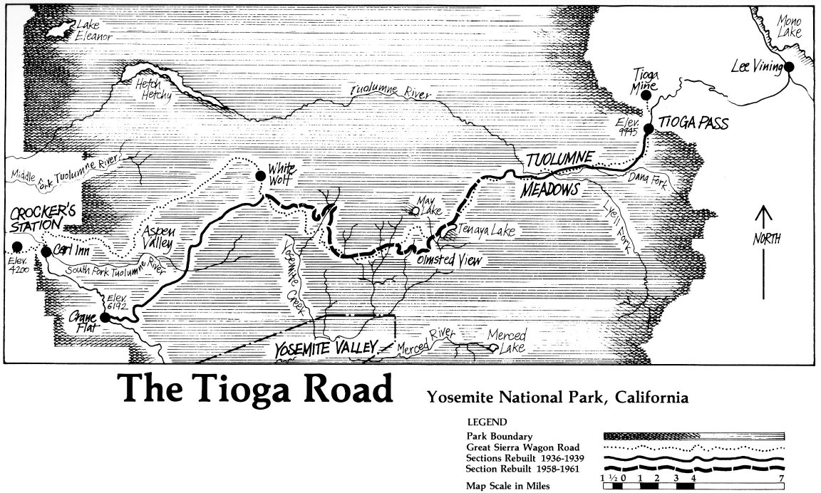
From Mono Lake and the town of Lee Vining, the eastern entrance to Yosemite Nat'l Park is by way of Tioga Pass, CA highway 120,  a cliff-hanger and steep climb up 3000' in 12 miles to the summit just shy of 10,000' at the park's entrance.  I would not recommend this route in larger RVs, especially if you like to pull over, as we do frequently, for photos and short hikes.


Up we go

Well yes, there's always one or two!

We were checking places off our "to-see" list as the departure day from June Lake base-camp approached.  We could not leave without seeing the upper Yosemite which was closed on our last attempt due to snow over Memorial weekend.


Use a bit of imagination and you can see a waterfall!


Smooth granite domes, craggy peaks, alpine lakes, and spacious meadows embody the character of this High Sierra.


Ellery Lake

Tuolumne Meadows will be in full bloom this summer

Pristine Tenaya Lake

Smooth granite domes provide fun hikes

....both up and down!

Half Dome from Tioga Pass..the 'other' side


If you read our previous entry on Mono Lake you know this day (not really today's day, since I'm way behind) started at 4 a.m., so by the time we traveled from east to west on Tioga Pass, with a lot of stops along the way, then returned the same way, with more stops to catch different light and views, it was another very long, but amazingly beautiful day along our way!


But it's time to move on.....

Friday, December 28, 2012

Top 20 Travel Destinations for 2012

1. Anza Borrego Desert:  Our new year most always begins here. This is our happy place, our attitude adjustment, our return on investment. Overwhelmingly beautiful, yet fierce and unforgiving; it suits our fancy.  Boondock favorite...

2. Ajo, AZ:  We've buzzed through Ajo many times on our way to other destinations, but enough friends and bloggers convinced us it was a destination! We stayed a month, boondocking, off-roading, photographing, and enjoying the great little town.


3. Pismo Beach, CA:  The State Beach Park has large, grassy sites with no hookups.  Paths lead to huge sandy dunes with blooming ice plant, and groves of gnarly Eucalyptus trees housing seasonal migrating Monarch butterflies.


4. San Francisco:  We never tire of this beautiful City by the Bay, though there are several; New Orleans, Vancouver, and Seattle, to name a few. But this is the only one with...The Golden Gate Bridge!


5. Bridgeport, CA:  A plan had been percolating and Highway 395, in the Eastern Sierras, took shape.  Thus we discovered Bodie, a genuine ghost mining gold town near Bridgeport... 

6. Mono Lake:  Continuing on 395, Mono Lake became a fascinating photo challenge.  We would depart our June Lake home base for early morning and late afternoon shootings of tufa towers, and calcium carbonate spires and knobs.  The lake is 2 1/2 times as salty as the ocean...


7. Bishop, CA:  Bakeries and bristlecone pines awaited us about 50 miles south.  The world famous Shats Bakery would become a regular stop on our daily outings to commune with the bristlecone pine forest, ancient sentinels over 4000 years old....


8. Lone Pine, CA:  The last stop on our 395 adventure but certainly not the least!  It is the gateway to Mount Whitney, the tallest peak in the lower 49 states, sweeping upwards of 2 vertical miles from this high desert location.  Nearby, the Alabama Hills presented an enchanted, convoluted vision of keyhole canyons and steep slopes of shattered granite boulders...


9. Port Townsend, WA:  A slice of pure heaven; friends, views, even the weather cooperated though August is the premier time to visit this favorite Northwest location.  We have waterfront parking at the Point Hudson Marina.  A Victorian Seaport and Arts Community...


10. Arches National Park:  Our arrival in Moab was a bit overwhelming; the crowds, the uncertainty of our stay. And we have a schedule which precludes our usual ability to be spontaneous, in an effort to re-visit many of the National Parks in Southern Utah.  Though we did prevail....


11. Canyonlands National Park:  The northern part of Canyonlands is known as The Island in the Sky.  A scenic drive follows the rim of this sheer-walled mesa with pull-outs where you get amazing views of the surrounding country virtually 1000' straight down, including canyons that have been carved by the Green and Colorado Rivers... 


12. Bluff, UT:  Goosenecks, Gods, and Petroglyphs were all in a day's drive from our fabulous boondocking site at Sand Island BLM Campground.  We had never heard of, much less seen the phenomenon awaiting us at Goosenecks State Park or the wonders of The Valley of the Gods, a miniature version of Monument Valley... 


13. Capitol Reef National Park:  Arriving at Capitol Reef was like finding an oasis in the midst of colorful red cliffs, massive domes, soaring spires, and twisting canyons.  Named Capitol for the white domes of Navajo sandstone, and Reef, the local word referring to any barrier to travel, describing the rugged upthrust known as the Waterpocket Fold.


14. Snow Canyon State Park:  Just when I think we topped the charts of landscape beauty, we drive into Snow Canyon, and there is a jaw-dropping moment of complete sensory overload.  Scenic is an understatement for this park tucked amid lava flows and soaring sandstone cliffs, petrified sand dunes, and volcanic cones; a strikingly colorful and fragile desert environment... 


15. Zion National Park:  An easy day's drive from our St. George location for the Huntsman World Senior Games.  Zion...A sanctuary, a refuge; a sacred place considered perfect of ideal!  Zion National Park is all of that and more.  Everything takes life from the Virgin River's scarce desert waters.  Water flows and solid rock melts into cliffs and towers... 


16. Pagosa Springs, CO:  We arrived in Pagosa Springs, east of Durango, on a crisp, sunny fall day mid-October.  This was to be our birthday celebration so for 3 glorious days spent at the Healing Waters Resort and Spa we sunned and soaked and enjoyed great dinners out.  The fall colors were worth the drive alone...


17. San Juan Islands:  Anacortes, WA is homeport to the San Juan Islands and conveniently situated half way between Seattle and Vancouver, BC.  The Washington State Ferries are at our beck and call for those day trips to the San Juan Islands and Victoria on Vancouver Island...


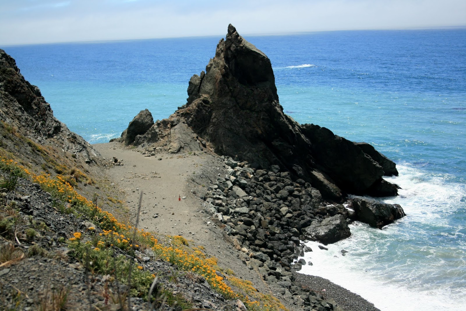
18. Big Sur Coast:  Touted as one of the world's top driving tours according to National Geographic, though doing it in a motorhome takes on a whole new perspective!  This rugged and picturesque narrow two-lane road twists and turns, suspended precariously over deep chasms, held in place by viaducts, and threatened by landslides...


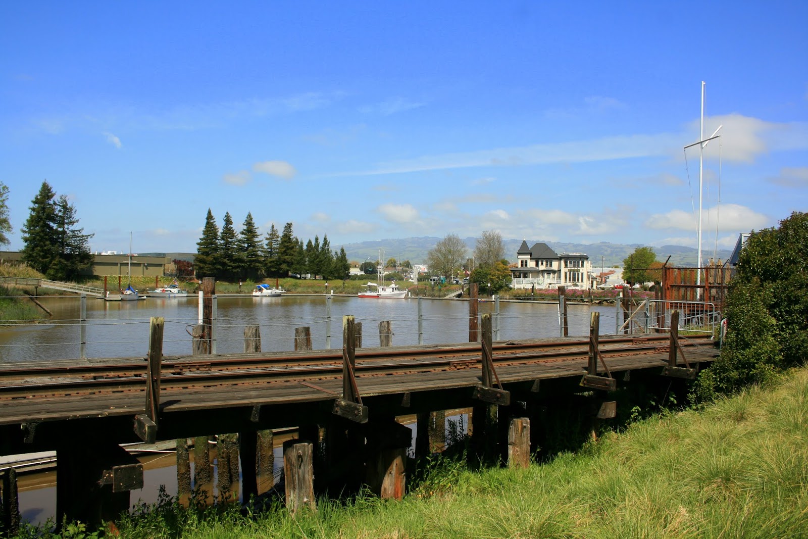
19. Petaluma, CA:  During spring and late fall our migration pattern brings us into home territory where Petaluma becomes our home base. This lovely historic town with its old Victorian architecture offers up great restaurants, cheese factories, sustainable farms, with the Napa Valley wine country just a short drive away.  And we have family....


20. Half Moon Bay:  The Coastside area is home to commercial fishing, pumpkins, flowers farms and giant waves known as Mavericks.  Just 30 miles south of San Francisco on narrow, windy Highway 1, this sleepy coastal town was "discovered" during the Silicon Valley tech explosion.  This is home territory for yours truly...